
Pedestrian Walkway Markings in Greenfield
Get in touchA Pedestrian walkway sign is a vital part of any space that carries foot traffic.
Good markings for pedestrians do not just ensure their safety but dictate where they can cross and where the road meets the walkways.
We have produced a wide range of different pedestrian walkways across countless projects in Greenfield, helping to mark out safe areas on high-traffic surfaces.
We can create the marking options you need to make your road space safe. Whether you are looking to protect foot traffic from motorists or just want defined road line markings and walkway areas.
We can offer the markings you need to make your space safe and usable.
If you would like to find out more about the other road marking services we offer in Greenfield don't hesitate to get in touch with a member of our team today.
Types of Pedestrian Walkway Markings
A Pedestrian walkway sign is designed to enhance pedestrian safety and make it clear where pedestrians can safely walk. They are typically found in high-traffic areas, such as near schools, parks, and shopping centres.
Here are some of the most common types of pedestrian walkway markings:
Crosswalks
Crosswalks are the most basic type of pedestrian walkway line marking. They are typically found at intersections and are designed to help pedestrians cross the street safely.
Crosswalks can be marked in a variety of ways, including with painted lines, textured pavement, or coloured materials.
Zebra Crossings
Zebra crossings are similar to crosswalks, but are marked with a series of parallel white stripes. Zebra crossings are often used in areas with heavy foot traffic, such as near schools or parks.
Shared Use Paths
Shared use paths are designated pedestrian paths that are also open to bicycles and other non-motorized vehicles. Shared-use paths may be marked with painted lines, coloured pavement, or other materials.
Pedestrian Islands
Pedestrian islands are raised or lowered sections of pavement that provide a safe space for pedestrians to wait in the middle of a busy street. Pedestrian islands may be marked with painted lines or other materials to make them more visible to drivers.
School Zone Markings
School zone markings are pedestrian walkway markings that are specifically designed for areas around schools.
They may include crosswalks, zebra crossings, or other markings that help to slow traffic and make it easier for children to cross the street safely.
Textured Pavement
In some cases, pedestrian walkway markings may include textured pavement. This can help to provide tactile feedback to pedestrians with visual impairments, making it easier for them to navigate the space safely.
Pedestrian Walkway Marking Cost Greenfield
The average cost of marking walkways for pedestrians varies between £600 to £1000 based on the situation.
In general, the larger the site and surface - and the more markings that are required - the more it will cost.
However, this price is highly flexible, depending on what line marking and safety elements are installed.
One marking option may be more expensive than another marking purely due to the amount of effort it takes to create said marking.
We aim to keep our walkways markings affordable to ensure that pedestrians, traffic and nearby workers are all kept safe near any road.
Our markings can be applied to any road surface as needed, whether they are used for safety reasons or for marking simple areas and road directions.
Benefits of Pedestrian Walkways
A pedestrian walkway line marking provides a range of benefits for both pedestrians and drivers. Here are some of the key benefits of pedestrian walkway markings:
Improved Safety: Pedestrian walkway markings are designed to improve safety for pedestrians by making it clear where they should walk and cross the street. This can help to reduce accidents and injuries.
Increased Visibility: Pedestrian walkway markings can be highly visible, which makes them easier for drivers to see. This can help to prevent accidents by alerting drivers to the presence of pedestrians.
Clearer Traffic Flow: Pedestrian walkway markings can help to improve traffic flow by directing pedestrians to cross at designated locations. This can reduce congestion and prevent accidents.
Enhanced Accessibility: Pedestrian walkway markings can be designed to be accessible for people with disabilities, such as those who use wheelchairs or have visual impairments. This can help to make public spaces more inclusive and accessible for everyone.
Aesthetically Pleasing: Pedestrian walkway markings can be designed to be visually appealing, which can improve the overall look and feel of public spaces.
Increased Pedestrian Activity: Pedestrian walkway markings can help to encourage more people to walk and bike, which can lead to a range of health and environmental benefits.
Thermoplastic Pedestrian Walkways
We understand how to start marking out a pedestrian walkway sign based on an area's shape, marking out the safe areas to start crossing and locations where pedestrians need to be careful where they are standing.
Marking out walkways in Greenfield is important for ensuring maximum safety and minimal accidents, no matter how much traffic uses that road.
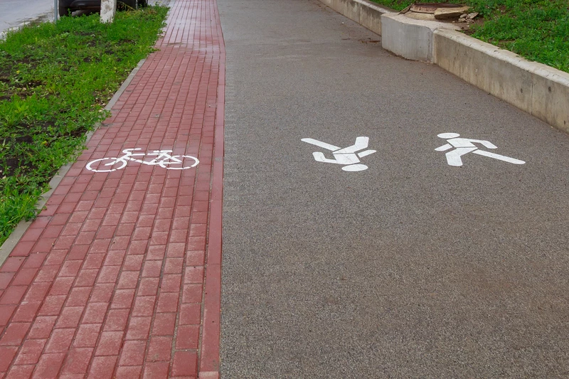
Walking Man Symbol Car Park Marking
The man walking pedestrian sign is a core part of all pedestrian walkways and safety zones, showing where foot traffic may choose to walk. This creates clean outlines that mark the road from any walk spaces nearby.
While this might be one of the most basic markings you can include on any surface, it is also one of the most important markings in common use. Simple marking can go a long way towards protecting the public.
The man walking symbol marks that an area of road is safe to walk on or at least designed to accommodate pedestrians.
This may be useful for marking unconventional walkways in Greenfield, such as ones placed on the very side of the road rather than on separate pavement.
Bespoke Pedestrian Walkway Marking Design
We can produce pedestrian walkways to match each surface and situation.
Each design we create conforms to the needs of our clients, whether that is safety-marking walkways near heavy traffic and large vehicles or pinpointing cycle lanes on roads.
What Colour Are Pedestrian Walkways Marked?
A variety of colours allows us to create markings that can be distinguished at a glance. Installation of safety features alongside a coloured line marking can mark anything from the beginning of walkways to areas where workers may need to cross busy stretches of road.
Different colours are used for pedestrian walkway markings to convey different meanings. Here are some of the most common pedestrian walkway marking colours:
White: White is the most common colour used for pedestrian walkway markings. It is typically used for crosswalks, zebra crossings, and other designated pedestrian areas. White markings are highly visible and help to make it clear where pedestrians should walk.
Yellow: Yellow is often used for shared-use paths, which are designated pedestrian and bike paths. Yellow markings can help to distinguish these paths from other areas of the road and make it clear that they are for non-motorized traffic only.
Red: Red is sometimes used for special pedestrian zones, such as pedestrian plazas or areas with heavy foot traffic. Red markings can help to make these areas more visible and help to reduce accidents.
Blue: Blue is often used for markings that are designed to assist people with disabilities, such as textured pavement or markings that indicate the presence of a curb ramp.
Green: Green is sometimes used for bike lanes or pedestrian paths that are separated from vehicle traffic. Green markings can help to make it clear that these areas are designated for non-motorized traffic only.
Orange: Orange is used for temporary pedestrian walkway markings, such as those used during construction or special events.
By making it clear where pedestrians should walk and cross the street, these markings can help to reduce accidents and make public spaces more accessible for everyone. Pedestrian walkways could lead to different areas such as fire exits.
What are Pedestrian Walkways?
Pedestrian walkways are designated paths or areas that are intended for pedestrians to use when walking, running, or jogging. These walkways can be found in many different locations, including urban areas, parks, and residential neighbourhoods.
They are often marked with painted lines or signs to indicate that they are intended for pedestrian use only, and may also include features such as benches, streetlights, and landscaping.
Pedestrian walkways are designed to provide a safe and convenient route for people who are walking or jogging, separate from vehicular traffic.
They may be part of a wider network of walking and cycling routes, such as shared-use paths or greenways, which aim to encourage more people to use active transportation and reduce reliance on cars.
Pedestrian walkways are an important part of the country's efforts to promote sustainable transportation and reduce congestion and air pollution.
They provide a safe and healthy option for people to get around and can help to make cities and towns more pleasant and livable places to be.
FAQs
What is the Purpose of Pedestrian Walkway Markings?
The purpose of pedestrian walkway markings is to enhance pedestrian safety and make it clear where pedestrians can safely walk.
They can help to reduce accidents, improve traffic control, and make public spaces more accessible and inclusive.
Pedestrian walkways can be in workplaces such as warehouses, this is so the workers have their own pathways when other employees are dealing with heavy machinery such as forklifts, which overall creates a safe working environment.
Are There Any Laws Related to Pedestrian Walkway Markings?
There are laws related to pedestrian walkway markings, such as laws requiring drivers to yield to pedestrians in crosswalks and other designated pedestrian areas.
These laws vary depending on the jurisdiction, so it is important to check local laws and regulations for specific information.
Can a Pedestrian Walkway Sign be Installed on Any Road?
Pedestrian walkway markings can be installed on any road, but the decision to do so will depend on a variety of factors, including traffic volume, pedestrian activity, and available funding.
What is the Standard Width of a Pedestrian Walkway Marking?
An average pedestrian walkway marking is between 4-6 inches wide.
Whereas a wide pavement marking is double the width of a normal marking which will be around 8-12 inches wide.
Get In Touch
If you are ready to get extra safety markings added or want a whole marking overhaul installed, then our experts can help you get the markings you need to keep the public safe.
Vehicles and pedestrians can be a huge danger to one another, and good markings can be the difference between complete safety and multiple accidents in Greenfield.
Other Services We Offer
https://carparkmarkings.co.uk/cycle-lane-markings - Cycle Lane Markings
https://carparkmarkings.co.uk/parent-and-child-parking-bay-markings - Parent and Child Bay Markings
https://carparkmarkings.co.uk/disabled-bay-marking-installer - Disabled Bay Marking Installers
https://carparkmarkings.co.uk/ev-bay-markings - EV Bay Markings
https://carparkmarkings.co.uk/hatched-area-bay-markings - Hatched Bay Markings
We cover Greenfield (Greater Manchester)